13 November 2012

Troutbeck round and up and down then whoosh......

It was forecast a beautiful day, sunny skies with only cloud to come later in the day.  Perfect for a wander up and over some, as yet, un-ticked Wainwrights but before any of that we took a quick trip into Ambleside before heading to Troutbeck and the views behind us as we climbed up out of Ambleside were stunning.  A thick layer of cloud lay nestled over lake Windemere obscuring any view of the lake or the surrounding land.  It was simply stunning and the first photo opportunity of the day.


Arriving Troutbeck just before 9 we found a perfect spot to park and it was on with our boots (and new hat!) and time to get going.  6 summits was our target for today Sour howes, Sallows, Yoke, Ill Bell, Froswick & finishing off with Troutbeck Tongue.  Early on in the walk we could clearly see the route we'd take showing the full round in all its spendour.  We were only on the road a short while before we headed left up a path that would take us up to our first target Sour Howes.


The going was fairly easy, a bit boggy and muddy in places but nothing too bad compared to the mudbath of last weekend.  The most noticable thing was the temperature.  There was hardly any wind and with the sun out it made it quite warm.  Warm enough to dispence with gloves and hats and before we reached the top jackets were put back in bags.  The views opening up were spectacular and certainly made the going easier.  The cloud was still like a thick blanket over Windemere and other surrounding bodies of water.


Finally on the top and we could now see clearly for miles.  We had a quick snack stop (banana) , although I wish I'd picked a dry patch of ground to sit on as I did get a little bit dirty and damp sitting on the piece of grass that I chose.....big mistake!!!! Up and onwards quickly again to the sounds of "I told you so" lol, we headed over to our next target on a path that was quite clearly marked but proved quite boggy in places.  There were a few people on the route.  A group of 3 kids, one with a very deep voice that we passed and a young couple who seemed to be on the same route as us.


Sour Howe and Sallows under our belt our next Target was Yoke and probably for me the most pleasing summit of the day.  Once out of the muddy track we were following we were met with a more man made path that wove its way up to the summit.  It was solid underfoot and quite pleasing to walk.  We were making good time and the weather was still with us however it was getting a tad breezier and jackets were now back on, as were hats and gloves.  


The summit of Yoke proved an excellent place to stop for lunch and sheltered round the back of of the rocks at the top was wind free and still being warmed by the sun we ate our sandwiches (ham that slightly tasted of banana) and got the map out to see what we could see around us.  High Street was over to the left and there was a most impressive ridge linking 2 gorgeous hills together.  Soon we were joined by the young couple we'd met earlier in the day and they were on their own Wainwright hunt.  Luckily for them they both worked at GO in Warrington and regaled tales of having their paycheck spent before payday on all sorts of lovely gear.  We wondered if we could get Saturday Jobs at GO just for the discount lol.

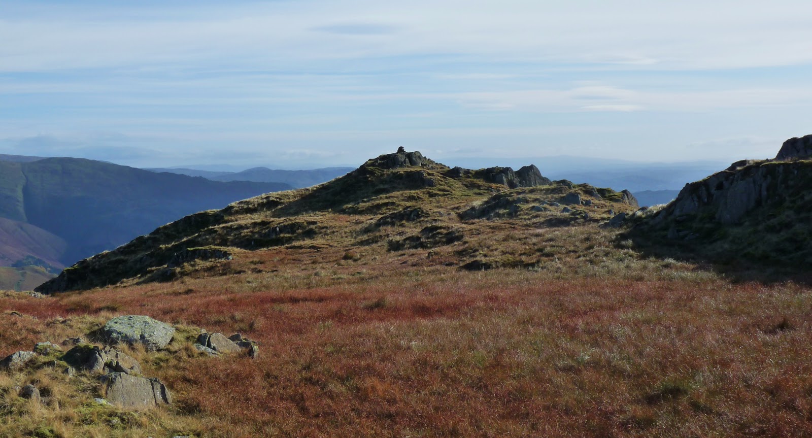
Onwards again over towards Ill Bell with its distinctive cairns on the top.  3 in total and the middle one we decided was the true top as it was the highest.  The views West now took our eyes over to the Helvellyn Range with some spattered snow still on the summit.  I think it was about this point that I started to sing a Christmas tune......it was the snow that did it, honest..... and was promptly told that if I sung another Christmas song before December I'd be given a puppy.  What would I do with a puppy lol, Funniest moment of the day.  (don't tell anyone but I did accidentally start singing another christmas tune later in the day but bit my tongue quickly, I don't think I was heard eeeek!) 


Down off Ill Bell and heading to the 5th summit of the day Frostwick.  Down another rocky steep path and then back up again.  Frostwick was a nice little hill and we met a man at the top heading in the other direction who delighted in pointing out the hills surrounding us.  Summit touched and it was off back down again heading for the last summit of the day.  Not really a summit as it lay nestled in the base of the arc we'd just come round but it was a summit none the less.  The views right out to the sea were stunning with Windemere now free of cloud.


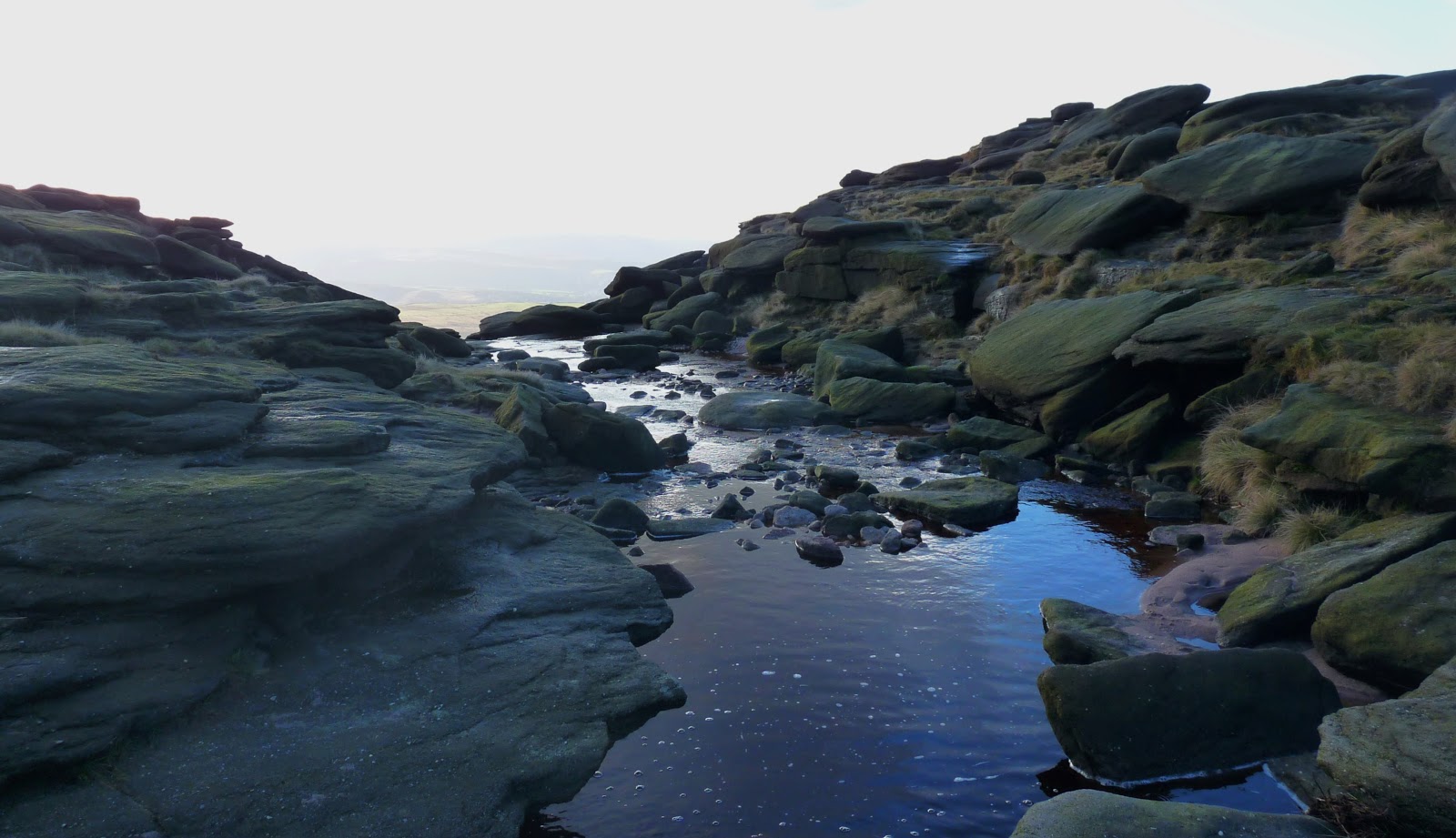
Following the path down and round towards Troutbeck Tongue it was actually pretty easy going.  Nice and soft underfoot and a distinctive path through the grassy banks that was pretty easy to follow.  My camera decided to stop working so I took the battery out and put it away in my bag which turned out to be a good call as the path soon met with a little river and our footing became just a little slippier than I'd anticipated.  One bad footstep and my legs were taken from under me and found myself on what only could be described as a slide in one of those water parks.  Only this slide wasn't smooth fiberglass or plastic this one was mucky and dirty and wet and damp but had all the propulsion of a flume.  Sliding down the path I went, not able to stop myself until finally I came to a halt covered in wet sticky mud, grass and worst of all prickly thorns.  Little fine whispy thorns in my hands, on my legs and it was such a ridiculous situation to be in there was only 1 thing to do.....laugh.  I probably have been wetter and muddier at any evening winter BMF class but there you didn't still have 3-4 miles to walk up and down a big hill but it was all good.  An added bit of adventure to the day and what is now, as I look back, a very funny moment.


After all the sliding drama we made our way up Troutbeck Tongue.  The sun has gone now and the temperature has dropped slightly but we're still making good time even with me stopping every now and then to remove a wee prickly thorn.  We spotted a bird that was quite unusual.  I'd seen a couple earlier in the day but their wings made an unusual flapping sound and their cry wasn't one I'd heard before.  In the distance we could see a black object that held the interest of the bird.  Too large to be a rabbit or small rodent and too small to be a sheep but we were too far away to see what exactly it was.  Forgetting completely that I had the binoculars in my bag we watched it till it disappeared still not knowing what it was. 

Troutbeck Tongue proved an easy descent and soon we found ourselves on flat land again, our route towering behind us and in front of us the most unusual stile ever.  Of course you had to go over it.  It was there, wasn't it but served no purpose as a stile other than its shape lol.


And before we knew it we were back at the car and I was slightly drier but still as muddy.  11 miles of delicious lakeland views, 6 Wainwrights, outstanding company and a brilliant day's walking.  My only wish is that one day I'd like to finish a walk without looking like a creature from the black lagoon or some refugee from some god forsaken land.......fingers crossed for next week.  I really do love the lakes and all the entertainment they bring. :-)


05 November 2012

Kinder Surprise......

The lakes were calling however the weather had other plans and high winds, rain/snow, low cloud and poor visibility was forecast so we decided to make other plans and according to the forecast Derbyshire was the place to be...........so off we went heading South to Kinder in the hope that we'd have a good walk and get some great pictures, which is always top of the walking agenda.

We arrived at Edale and after a quick trip to the visitor centre to get a local map we parked up in the car park, changed into boots and coats and headed off up the track.  The first thing we noticed was that the weather wasnt all that great, drizzly rain and mist and it was cold.....well it is November so I guess I can let that one slide.  The second thing we noticed was that there seemed to be a lot of people.  Groups of kids chattering away, some well equipped with all the gear and some in wellies.  As walkers we are selfish and do like having the hills to ourselves.  If nothing else people get in the way of pictures as the last thing you want is a luminous pink or green or yellow jacketed person interfering with a beautiful view hehe!


The first incline was a tough track up through some rocks beside a trickling river and I definitely found it hard going.  I was still suffering from Thursday's BMF class and thigh muscles were burning especially on the incline but as with all hills, its just one foot in front of the other and soon enough we were at the top but not before being nearly mauled by a rogue Alsatian dog.  It came right up to me and growled and when its owner caught up and passed he make no acknowledgement at all that his dog had been less than friendly.  I know I've said it before and I'll say it again but on steep slippy rocks dogs should not be let loose to run up and down as they please, especially if its a busy route.......ok rant over!


At the top it was like Grand Central Station.  Groups of people coming and going in all directions and after a quick check of the GPS we made our way over the path that would ultimately take us towards Kinder Scout and the wide plateau that makes it unique.  The path brought us over past some distinctive rocks typical to this area and then to a crossroads with several choices to take.


Up to the left there was an area that had suffered erosion and was being attended to with a new path being created and then straight ahead there was a group that seemed to be climbing through the rocks and to the right there was a path up next to the river which was the one we ultimately chose as the little red arrow on the GPS said so :-).


It was a lovely wander up next to the river.  The weather was still bleak and it showed no signs of improving even though the forecast said there would be sun at some point.  Ever hopeful we plodded on and soon found ourselves at the edge of a meadow of deep trenches filled with mud.  Deep, sticky and unforgiving mud.


Our first thought was to keep heading forwards and get through this area as quickly as possible so with several jumps and detours round the trenches we found that we were making slow progress.  Over to the left there was a group that seemed to be making better progress but we knew that the path we needed was over to the right so after much too'ing and fro'ing and jumping around and over the trenches we knew that there was nothing else for it but to run as fast as we could through the mud so that we wouldnt sink as far whilst making our way over to the right.  It tested patience as at one point I just couldnt see a way thought and after over an hour and making very little headway it was incredibly frustrating being knee deep at some points in the mud it was a struggle to keep a smile on my face but good god you really did have to laugh our you'd go mental.


Luckily Mr Navigator kept his head and steered me, without comment (thankfully) to the right path and it was a joy to finally see the river path that we should have been on.  Hurrah! We'd made it through the mud and could now stop for first lunch as by this time I was really hungry.


As well as the elation of being out of the mud the sun came out and the sky cleared to the bluest of blues apart from a few billowing clouds.  Tummies full and spirits lifted we made our way along the river path that would bring us out at the top of the downfall.


The downfall was brilliant. The last time I was here it was frozen but this time it was flowing, albeit not fast but flowing all the same and with the wind of the day quite a bit of it was blowing back and was a superb sight.  We made our way down off the path, through the rocks to get a better view and stood for a while mezmerized at the swirling water.


Back up onto the path it was still busy going both ways with people out for the day and we made our way through the rocks, enjoying the views now opening up to the side of us.  The next stop on our walk was Kinder Low and the trig point and it would be a mile or so along the edge before we got there.


The trig point was just how I remembered it.  A white pillar surrounded by large, round pebble shaped rocks.  Rocks smoothed by time and ice into the most spectacular shapes and the trig standing proudly on a pile of these is one of my favorite trig settings (so far).


Obligatory pictures taken we found the path off the top and decided to find a bit of shelter for second lunch.  It was about this moment it was noted that I'd been unnaturally whingy all day and not my usual positive cheery self.  That mud had a lot to answer for.  That coupled with the fact that my nose had run ALL day and I was running out of dry tissues so it was now sore made me just a little bit grumpy.......so the moral to this part of the story is always make sure that you 1.  Don't leave your gaiters in the car and 2.  That you have enough dry tissues with you to cover all eventualities lol.

Lunch done and the path downwards taken again.  It was a beautiful paved path and was taking us towards the next installment in our walk.  Jacobs ladder.  Jacobs ladder was the last stretch downwards and was a beautifully paved piece of path that wove its way down the hillside towards the bottom taking us off the Kinder range and back on the road towards Edale.


We still had a few miles to go and the light was fading.  This coupled with the fact that the rain was starting again make us quicken our steps so that we didnt get caught out by the diminishing light.  Through little farms and up paths towards Edale we saw the winding path down the hillside to the right that we'd come down earlier today however this time we could see blue flashing lights coming down it and sure enough a few 100 yards ahead we saw the Mountain rescue team reach a chap wrapped up on the ground in a bivi bag who'd fallen and injured his leg.  The blue flashing lights were obviously for him and the rescuers were all in attendance with various pieces of equipment from stretchers to first aid kits and before long they had a tent erected around the injured party and tending to the situation.  (we found out later via a google that the poor chap wasnt too badly injured and most likey had sprained his ankle or something similar, so alls well that ends well).  No picture of this event as we didn't think it was the done thing to ask the poor injured chap to pose, and anyway the light wasn't that good lol.


After this episode we were back in Edale and it was a short walk down the road back to the car park.  We were tired, dirty, a bit damp but we'd had a good day.  Yes I was a little bit whingy but what an interested and unexpected walk it turned out to be.  I missed my lakes more than you could imagine but our legs got a work out and although we probably wont be back here anytime soon, we will be back as the true top of Kinder is still to be touched........perhaps I'll pack my wellies in my bag next time.......please, please, please let the weather be ok for the Lakes next week :-)

29 October 2012

3 Crags and a Knott

Today's walk would take us back to Grasmere and the wonderful peaks that surround it.  Helm Crag (or the Lion and the Lamb) had been on my to-do list for a while so today it would be the last peak of the day after we'd tackled Tarn Crag, Calf Crag and Gibsons Knott ending up at the beautiful Helm Crag but not before a wander over to Easedale Tarn to take some pics. The intention had been to stop off at Rydel Water on the way through for more "mirror like" lake pictures but it was a bit choppy as we drove past so continued to head up to Grasmere.

Arriving early the morning sun was casting all the surrounding hills in a lovely orange glow.  Autumn is truely upon us and the trees are shedding their leaves and will soon be bare and icy as the cold winter winds arrive.  

On the route up to Easedale Tarn we visited Sour Milk Falls.  A series of tumbling water down the hillside was a very pretty sight indeed.  Veering from the path we followed the falls up the side taking every opportunity to capture the water cascading down at its very best.  It was a lovely climb up through the rocks staying very close to the water as it made its way down and a much more interesting route up instead of the designated path.  As the official photographer's  photographer it was an ideal opportunity to get a good shot :)


Easdale Tarn was next on our agenda as we made our way through bog and grassy areas.  It was a good job that there had been a hard frost the previous night or we'd have perhaps needed full waterproof gear as even with the frost some of the boggy areas were still a bit wet....oops!  On the way up to Easedale Tarn we were on the path then off the path, through bog and we must have crossed the river about 4 times picking our own individual route up the mountainside which was much more fun however that wouldnt be our only "off piste" moment of the day as we approached Easedale Tarn and saw the scrambly rock fissure scarring the side of Tarn Crag we never knew then that this would be our way up. 


The wind was getting up now and we'd been relatively sheltered on our walk up but were now exposed to icy blasts which meant hats and gloves back on and jackets zipped up.  Time for a drink and something to eat so we had a quick lunch stop 1 behind a big rock which seemed to be actually in the river.  The temperature and wind meant that you couldn't sit for long before the chill set in so after a bit of fruit a nibble on some nuts and a drink we were up and moving again to continue round the Tarn to the other side where we'd start the climb up to Tarn Crag. 


The sky was fantastic as clouds were moving in and out all the time, obscuring the blue and causing waves and ripples of white fluffy cloud.   The views of surrounding mountain ranges were coming into view and we could start to pick off areas we'd been previously and areas we'd still to target.  So many hills and so little time.  I could easily spend the rest of my days between here and Scotland......now where did I put that lottery ticket!


The climb up to Tarn Crag was steep, rocky, slippy and sapped every ounce of strength I had.  At the bottom, you look up and think.  This is going to be tough but I can do this.  One foot in front of the other and that's all it takes.  You know that from the bottom what you see isn't exactly what you're going to get.  It will be steeper, it will be harder and the top that you see isn't the real top, its hiding behind after more steep climbing but you do it, you take that first step up the seemingly impossible because you can and because the elated feeling once at the top is like no other feeling in the world.  The sense of accomplishment is indeed a good feeling.  So up we went.  Taking our time, zig zagging on the very steeps bits so not to loose our balance and sometimes using both hands and legs but we got to the top in one piece and with smiles still firmly affixed.  Leg muscles aching but recovering quickly it was an exhilerating part of the day. 


Up a the top of Tarn Crag it was now very windy.  The little pools of water near the summit were still iced over and the grassy areas were frosty.  The temperature must have been minus something and the air bit into our faces.  The summit touched we hunkered down in a sheltered area for a bit of refuelling.  I was glad I'd brought my thermos and enjoyed a quick drink of something warm and refreshing.  After our snack stop it was back on the path to follow the contour lines round the hill over the back to the route that would lead us to Calf Crag and the rest of the day's targets.


Oooh it was starting to get busier now, people piling onto the path from all directions.   All sorts of people young and old, some that said hello and some that just grunted and some that didn't acknowledge you at all which wasnt nice.....

Plenty of ups and downs on the way over to Calf Crag and then over to Gibson Knott but full of anticipation for what was to be a particularly exciting part of the day...Helm Crag with its lion and lamb rock formations as well as the infamous Howitzer (the true summit) which I am choosing to call the Wurlizer (no reason, it just works for me!).

The sky still filled with fascinating clouds framed the still magnificent views.   As we made our way round to Helm Crag suddenly the path appeared before us and you couldn't help but feel excited as you saw it snake its way up the hill.........on we go.


The Howitzer.  A lovely piece of rock, just waiting to be climbed so that I could say I'd bagged the true summit of Helm Crag but alas, today, it was not meant to be.  There seemed to be a few ways up through the rock and each of them, once attempted, brought me right back to the moment when I slipped off the bad step over at Crinkle Crags and my attempt was aborted.  I never realised until this moment how much that fall had affected me and its funny because the scar on my knee from that earlier fall had been itchy for the past few days.  Its as though it knew that I'd be faced with this dilemma today.  At the end of the day my legs are just too short for some of the climbs and I just can't seem to balance on small 1" wide bits of rock with the confidence I used to.  That bad step has a lot to answer for and goodness gracious me one day I'll tackle it and then be back to tackle the Wurlitzer.......I was angry and annoyed at myself at what seemed to be a simple 1, 2, 3 steps up through the rocks to the top but my mind just wouldn't let me.  I don't think I've ever been in a situation like that before and it took me a few mins to come to terms with the fact that I wasn't going to be doing that part of the climb today. 


So I settled for taking pictures of the still very stunning scenery around (no, I dont want to go up the lion lol!).  This walk today had been excellent.  The early enchantment of the waterfalls, the steep and rocky climb up the south face of Tarn Crag, the boggy bimble around to Calf Crag, the dodging of people and ups and downs over to Gibson Knott and then the drama at the Waltzers....Wurlitzer....Howitzer!

It was at this point the pub was mentioned and looking down to the road I could see it. The earlier disappointment was quickly forgotten and there was a sudden spring in our step.  The zig zag path down off Helm Crag had had some recent conservation work done but it was a good path and before long as we came down through the zig zags we were almost at level ground again.  Over to our right we could see the waterfalls of earlier in the day now cast in a different light and we easily found the road that would lead us back to the car.


Another day of sunshine and summits and memories created.  A day of ups and downs with some surprises and funny moments thrown in along the way.  I do so enjoy the Lakes and please whoever is in charge of the weather can they at least give us 1 dry weekend day throughout the winter for us to play with, thank you very much :-) xx

24 October 2012

A bimble up Ingleborough but Simon Fell short!

At a loose end .last Sunday and having no lakes and no Wales in my weekend it was suggested (and what a cracker of a suggestion it was btw) to take a wander up Ingleborough.  Not my usual route of parking on the road heading towards the Ribblehead Viaduct and going up the steep steps but to go via Clapham and take the route, up the back, over Little Ingleborough and back down via Simon Fell and then over again to Clapham.......well that was the plan!

The day was a scorcher and when I arrived in Clapham there wasn't a cloud in the sky.  My sat nav brought me right to the car park thankfully and it was already filling with other walkers, changing footwear and checking rucksacks.  My immediate thought was how do I get out of the car park.  After paying for my ticket I checked the downloaded route on my phone (now at 80% battery eeek!) and saw that I followed the river up through Clapham and the route would present itself to me..........easy peasy.  Plus there were other walkers heading in a similar direction so I sort of sauntered after them.  (Following people is not advised really as I found out later in the day......)


 The village is pretty and with the morning sun the trees glistened like gold, wandering past the church I was soon met with the "Trail and Caves" route.  A quick check of my phone (now at 72% battery) and the 65p toll paid I headed on up the path.  Glorious woodland with trees of every colour, golds, reds, burgandy, oranges all lit up the path and it wasnt long before I came upon the cave entrance.  This wasnt my destination today as I had much further to go and passed pleasantries with all sorts of folks that passed.  My pace was quick and and when an elderly man passed he said, slow down, you've got all day and I just replied but I've go so much to do and see and kept to the quick pace to get me out of the forest area and into the rocks.


A small scramble later and further along the path the sight of Little Ingleborough met me and I could clearly see the path ahead snaking its way up the hill.  Trundling my way through the rocks the path ahead was firmly in my sights and I was debating whether to have a quick rest stop at the bottom before tackling the first steep part of the day.  It was at this moment I realised that I'd forgotten my water bottles and only having my thermos of green tea with me that would have to do but it would have to wait as I wasnt really ready for a proper stop.   So onwards I went towards the path upwards.  There were 2 people in front of me a good distance ahead that I recognised from the car park earlier and behind me was a woman who wasnt gaining any ground and then I could hear the chatter from a group of young people so I plodded on as I didnt want company on the climb, just my own company would be fine as I put one foot in front of the other and continued up the path.


About half way up I really was thirsty so decided to stop on a flattish bit of rock to the side and have some tea and some fruit.  It was only when I looked back I realised that at the bottom of the hill was Gaping Gill, the big hole that I should have visited but good god I'd missed it completely in my keeness to get onto the steep path.  Oh well, nothing I could do about it now but hopefully I'd pass it on my return leg and checked my phone to see if my homeward path took me that way.  (phone battery now 54%...oh dear!)

Tangerine eaten I headed on up the path as the group of youngsters were getting closer and I wanted to make it to the top before they passed me.  Up on the top of Little Ingleborough there is a lovely little flattish path over to the main event and I was blown away by the views on offer.  Ingleborough in the past has always been a dark and foreboding place with hail, rain, mist, fog and all sorts of dreary weather thrown in for good measure.  Today I was seeing it in all its glory.  Pen y Ghent behind and Whernside up ahead.  It was beautiful and I could see as far as the Lakes and behind Pendle Hill stood proudly in the distance.


The final path up on to the summit of Ingleborough wasnt too steep and to my left I could clearly see the shelter, the big cairn and the tip of the trig so off in that direction I headed.  I was hungry now and looking forward to lunch.  A quick trip over to the trig for the obligatory picture and then I found a section of the shelter all to myself out of the wind and with views over to the Lakes.  Perfect.


It was perfect until the group of youths decided to invade my corner of the shelter and these weren't just any youths they were privelaged youths.  Talks of Vinyards in Switzerland and Skiing in Aspen and Vale were the topics of conversation so I had little to add and packed up quickly ready to find the route OFF.  I had a fairly good idea of where I was heading and knew that I had to find the path off the mountain to take me over to Simon Fell and thats the way I headed.  Quick check of the phone route (Battery now 32% oh crickey!) and I was heading in the right direction.  I decided to switch the phone off completely to save what battery I had left and as I took the path off the mountain I could see a couple ahead of me that I knew were parked in the car park at Clapham so that confirmed to me that I was on the right path......or was I?


Downwards I went, Simons Fell on my left and before long I realised that I was going down too quickly and Simons Fell was looming up to the side of me.  Had I missed the path, surely not?????  So I thought to myself I'll carry on down this path (heading to Horton in Ribblesdale) and perhaps there will be another path up to Simons Fell at the end.  Further down the path Pen y Ghent looming ahead I was very concious that I was heading away from Clapham and still could see no path to the left up Simons Fell nor to the right to take me back over to Clapham.  The weather was outstanding so there was no immediate danger so I kept heading along the path in the hope that one would appear either right or left.  Simons Fell was not to be.  I'd gone so far along the path now that it was behind me and there seemed no visible way up it.  It didnt look that steep and if I'd not been alone then probably would have attempted it but then again if I'd not been alone I'd have been on the right path in the first place oops!


So my focus was now on getting a path to the right to take me back towards Clapham.  I had a quick check of the phone (battery now at 20%) and saw quite clearly where I'd gone wrong and that I seemingly could still catch the path up ahead.  So onwards I went.  Mr and Mrs Car Park were still up ahead so I felt fairly certain that at any moment they'd turn off right and I could relax and after another 20 mins or so I saw that they'd come to a Y in the road.  They seemed to deliberate for a moment or two then headed off in the left hand direction which didnt seem right to me and sure enough when I got the Y the left hand direction was clearly signposted Horton in Ribblesdale.  This was not where I was headed so I took the right hand Y.  Not quite a path but enough of an indentation in the ground that convinced me this was the route.  I had Ingleborough on my right, Pen y Ghent to my left and slightly behind so I knew that I was headed in the right direction, path or no path this was the way I was going. 


I was all on my own, not a soul for miles and thoughts did cross my mind that I could be murdered out here and no one would be any the wiser.  I counteracted these thoughts by singing and continued along the path.  Little Ingleborough was up ahead on the right and I knew I had to get to the base of that to meet the path I'd come up on earlier in the day but it never seemed to get any closer at all.  It was at this point I thought second lunch sounded like a good idea.  So up on an embankment I popped with the gorgeous view of Pendle Hill in the distance and I treated myself to the rest of my lunch.  It was a welcome break and much needed in my relentless trudging towards the base of Little Ingleborough.  I dared check the phone one last time (critical less than 10% battery power) and before it died I could see that if I followed the wall I'd soon be back on the path that would take me to Gaping Gill which I couldnt miss this time!


Sure enough following the wall up and over banks I soon saw the fenced area that contained the hole and knew that I wasnt lost anymore and that there was a path, a path that would take me back to the car.  It still was a fair distance back to the car park but I did spend some time down at the hole's edge watching the water cascading down in the late afternoon sunlight.  There was another woman there and she seemed a bit lost and I did wonder for a moment if I'd interrupted her in some meditation moment, oh well never mind.


My mind now turned to the beautiful wooded area that I'd come through earlier and what the afternoon sun was doing to the trees.  So I quickened my step and hurried as fast as I could through the rocks, over paths, down through the scrambly bit to the wooded area by the lake and  it was like standing in a cathedral.  Light spilling through the trees adorning every surface....bark, ground, fences, water....beautiful sight.


Before long I was back in Clapham, the sun now very low in the sky and I'd had an amazing walk.  It had a bit of everything today.  Forest, rocks, a little scrambly bit, a detour (unplanned) and a great leg workout even if I did miss one of the inclines.  Clapham looked every bit as pretty in the evening sunlight as it had in the morning and I'll look forward to having a go at this route again at some point in the future and this time making sure that Simon does fall short!