26 November 2012

6 Wainwrights and a Howling End

Another epic walk in the Lakes was planned and this one differed from the others due to the fact that we weren't driving home afterwards but staying up in the Lakes to complete a full weekend of Wainwright walking.

At 85 Wainwrights, Chris's target was to complete his 100 this year and 8 were planned over the weekend which would make him closer to his target.  My tally so far was 25 which isnt bad considering I only stepped on my first Wainwright back at the end of August.  There was cold conditions forecast for Saturday and we hoped we'd see some snow or at least a good hard frost signifying winter was on its way.

So Day 1 the walk started from the village of Braithwaite and once parked we headed towards the start of the walk but not before stopping off at the village store for a bacon buttie and a trip to the loo and what a scrumptious bacon butty it was and just the right start for the day as we felt the cold air on faces walking up and out the village.


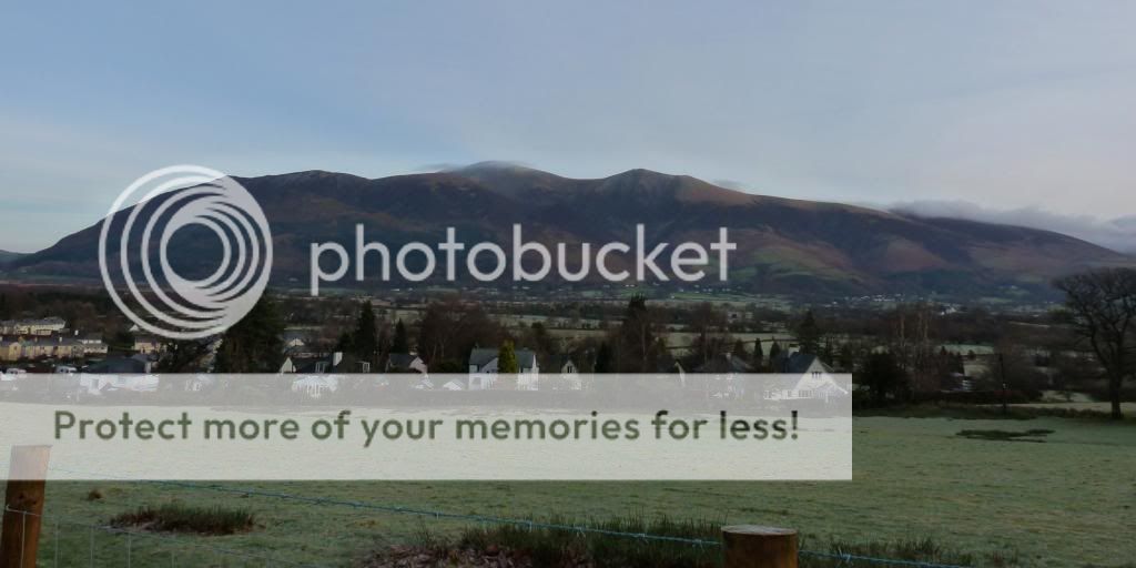
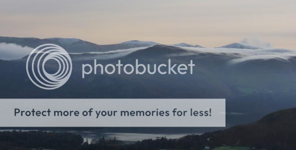
Even now, without any height, the views were spectacular.  We could see back towards Skiddaw and Blencathra and ahead the Lakeland views spread out before us with cloud nestled in every crevice.  Soft fluffy marshmallow like clouds with the sun's brighness filtered by the haze of the day made that initial climb quite exiting indeed.


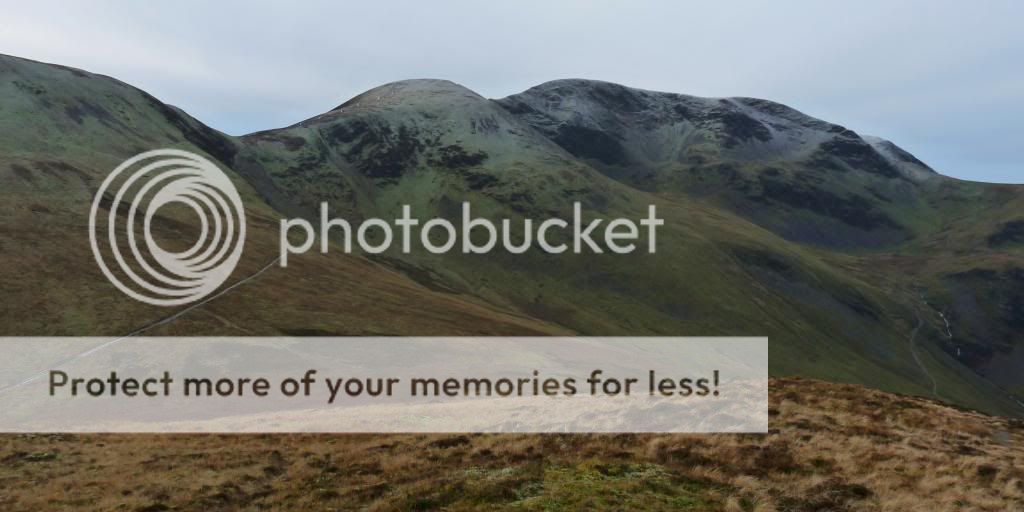
Over to the right of us we could see the dominating peaks that would be part of our walk for the day and each of them had a smattering of frost on the top making them look like they'd been sprinked with icing sugar.


Barrow was our first summit and it was a pleasant walk up a well defined path.  A little steep in places but nothing too taxing and a couple of false summits to tempt you into thinking you were there well before you'd reached it.  The weather was absolutely gorgeous with clear skies and hardly any wind with only a little chill nipping at your face.


After Barrow it was down and then up to the middle hill of Outerside before heading up the impressive Sail and onto Eel Crag.  It was a lovely winding path up and down the contours of the valley with Sail sitting right in front of us just waiting patiently for us to arrive.  The path up to Sail had been carved out of the hillside in a snake like fashion and although not everyone's cup of tea it served its purpose in taking your gently up the exposed hillside.  We didnt have the protection of the valley any more and the higher we got the stronger the wind was although it was still fairly mild just accented by the exposed side of the hill.


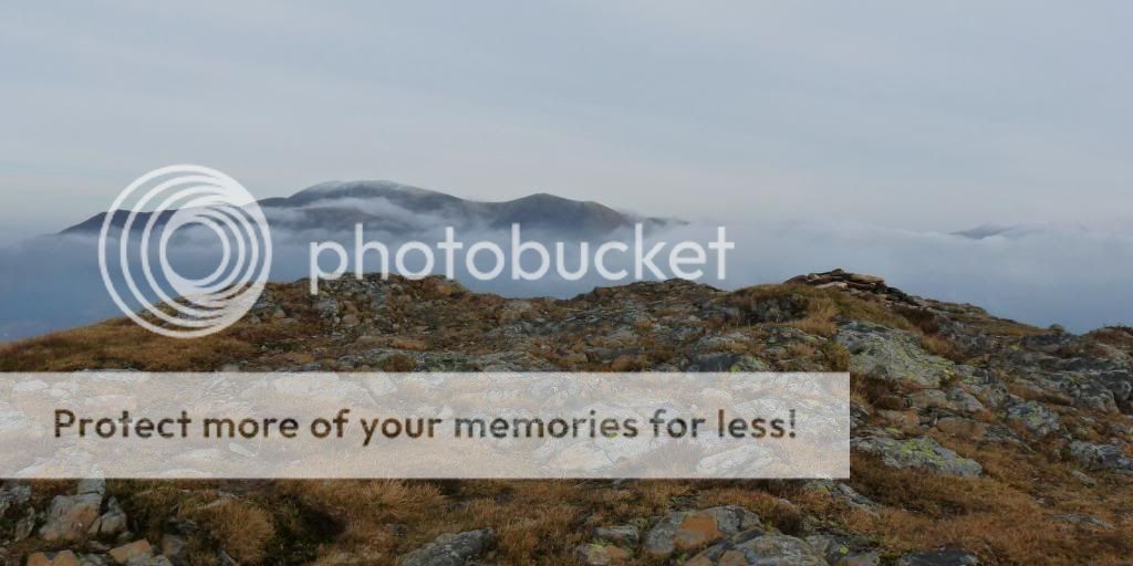
Once there, the top was frozen solid and the little cairn in the middle of a teansy weansy tarn was just not impressive enough for such a lovely hill but it was a fine picture opportunity with views stretching over to the Scafells white on top but not free of cloud and in the other direction the Helvellyn Range looking impressive with their white caps.


Onwards and upwards we step onto the path that takes us to the next high point,  Eel Crag.  Its about now that we're met with other walkers all heading in the same direction.  Groups of people all following the same path to the top.  I stopped a few times to let some past as the path was quite narrow but it wasnt a long climb up and soon we were standing in front of the trig point, hungry for lunch but a vast plateau with no shelter so it was off back down towards Sail to hopefully nestle in the valley between the 2 hills for a stop.


Off we went and instead of heading back up Sail we skirted round the side, avoiding the snake path and made our way down a more gentle path through frozen heather.  We found a spot against the bank within the valley between Sail and Scar Crags and tucked into our sandwiches and flapjacks.  Today would have been a good day for a flask of soup (something to remember for frosty adventures going forward) and we didnt hang around long as the temperature was still quite low.


Up onto Scar Crags and it was another nice little rocky hill for us to get a grip of.  Still frosty on top the most visible sight on the horizon was not only Causey Pike ahead but the Helvellyn range in front looking even more magnificent in the snow.  The route down to Causey Pike had a nice little bit of exposed ridge to it and I do love an exposed ridge so was looking forward to getting down there.  Oodles of picture opportunities but as we approached Causey Pike there were 2 figures on top which gave a sense of scale and although I have no idea who they are they now feature in this blog.


Up and onto Causey Pike we were met with a couple of women who seemed to appear from nowhere and had 2 dogs.  One was a little skittish sausage dog type thing who took a liking to me (jeez!!!) however when I asked its owner to put it on a leash before heading down the scrambly bit she obliged which I thought was nice.


Down the scrambly descent of Causey Pike gave us an option.  We could head off left down the path to the bottom and ultimately the end of the walk or we could continue ahead to Howling End................listen??? To go down that way to the road that would take us back to the path homewards.  No contest really as Howling End sounded too good to pass up.

 
A few more bits of scramble, a bit of boggyness but not too much and before we knew it we were back on the road and a short walk up behind the trees towards Braithwaite again where we'd started the walk.  Full circle and a day of beautiful views, excellent hills and a well rewarded drink at the Royal Oak which was indeed a lovely little pub and one we could have sat quite happily all night in.  There were other walkers in there who we'd met on the paths today and it had a lovely warm and cosy atmosphere which was as near perfect as you could get.  We'll be back there for sure one day.


20 November 2012

Nine Standards Rigg, Giraffe bread and a muddy end!

Its Sunday, the weather forecast is good, boots are cleaned, route is downloaded, sandwiches packed, a quick cuppa and we're off, in the dark, heading North to Kirkby Stephen. 

The drive up was beautiful as the more north we got the frostier it became.  Hedgerows white with a thick frost and as the sun came up behind us it burst with a fiery glow into the sky.  The skies ahead were tinged with pink and there werent many clouds which suggested we were indeed in for a fine day.

After a quick stop at Ingleborough for fuel and Sedburgh for the loo we parked in Kirkby Stephen and set off on the first part of our walk which would take us up past the quarries at Hartly and on towards Nine Standards Rigg.  It was cold, the fresh air biting our faces and definately hats and gloves weather but the sun was out, the sky was blue providing excellent walking conditions.
The first part of the walk was on a road, not the surface we're used to walking on however it was a pleasant wander up past the old railway viaduct and onwards through the valley.  The views were beginning to open up behind us and the road took us on a steady climb.

Finally the road ended and we were on a muddy path.  Thankfully the temperature meant that the ground still had some firmness to it and wasnt as muddy as it could have been.  Puddles were icy and there wasnt much slipping and sliding going on.

There were few fellow travellers on this route.  A man with 2 small children who seemed to be defiant at walking any further as children sometimes are and 2 men and a dog which came bounding up behind us all muddy and smelly.  Thankfully their pace was much quicker than ours and they were soon far ahead.

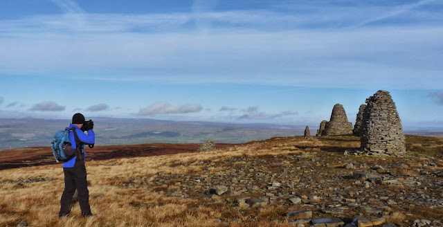
The Nine Standards were now coming into view after being on the horizon for so long finally they looked like they were getting closer and the last path to the top could clearly be seen winding its way up the hillside.  The towering pillars of rock stood triumphanty on the top of the hill and legend has it that they were built to trick any invading armies from the North that there was a strong army on the hilltop ready to attack.  Other legends have the stones dating back over 800 years.  Whichever the story they were an impressive sight and I'm glad we came here today.

We spent quite a while darting in and out of the stone pillars taking many many pictures and trying to catch the light at every angle.  They were all different shapes and sizes and so perfect in form after the 2003 rebuild and a pleasure to photograph.  The light wasnt too bad and throwing some nice shadows on the ground and the sky was perfect with wispy cloud throwing all sorts of shapes over the sky.  The wind was fierce and cut through you like a knife so after all our pictures were taken we headed off towards the trig point and the rest of our walk.  Just before the trig point their was a pillar with a dial on top which showed what we could see in each direction.  I'm sure there is a name for this but it was a great source of information for getting our bearings.  Old Man of Coniston - that way.  Blencathra - over there and the rest.


It was about the trig point we first encountered the mud plateau, slightly reminiscant of Kinder but not as vast.  It still tested us in making us look for suitable routes round to avoid most of the deep sticky stuff.  With the wind still blowing a fierce gale it was still quite chilly on the top and I was relieved when we turned right to take us back in the direction of Kirkby Stephen and onwards to somewhere we could stop for lunch.


First lunch was a bit late this week and it was a relief when we found shelter behind a rock formation, who's name escapes me but it had something to do with Haggs.  Sandwiches made from Giraffe bread and ham, flapjacks and some little chocolate rum things from Ikea which didnt go down well at all lol.  No, they wont give you a hangover but they were a bit rummy!


After lunch the descent starts and as we made our way down the path we could see some handgliders in the distance landing then dissapearing then landing again down what could only have been a cliff on the other side.  Handrailing the wall again we were on the path back to Kirkby Stephen and according to the GPS we had about 3 miles to go.  The weather was changing and the sun was now gone with dark ominus clouds coming over the sky.


The rain started just as we approached what can only be described as a mud bath.  Through a field of sheep, following the footpath signs the recognisable footpath ended and a sea of mud lay before us.  This was a published footpath and the farmer had obviously let cattle or some other big hooved animals wander through here regularly which made it choppy, muddy and almost unpassable.  There was nothing more for it but to keep moving forward through it in the hope that it would end.  It wasnt enjoyable slipping and sliding in the mud, boots caked, ankles caked and one false slip would mean everything was caked.  It was part of the day and looking back quite a funny part of the walk and soon we were through and had a dip in the river to see if we could get at least some of the mud off our boots.
We followed the river back to Frank's Bridge where we started the walk and soon enough we were wandering through Kirkby Stephen and back at the car.  A quick change of trousers and footwear and soon enough we were clean again for the drive home.
A good walk, another box ticked, for the best part it was sunny and worth the trek up to the Rigg but oh how I long for a scramble and a bit of height, rocks and beautiful ridges, I do believe I hear the mountains are calling........


13 November 2012

Troutbeck round and up and down then whoosh......

It was forecast a beautiful day, sunny skies with only cloud to come later in the day.  Perfect for a wander up and over some, as yet, un-ticked Wainwrights but before any of that we took a quick trip into Ambleside before heading to Troutbeck and the views behind us as we climbed up out of Ambleside were stunning.  A thick layer of cloud lay nestled over lake Windemere obscuring any view of the lake or the surrounding land.  It was simply stunning and the first photo opportunity of the day.


Arriving Troutbeck just before 9 we found a perfect spot to park and it was on with our boots (and new hat!) and time to get going.  6 summits was our target for today Sour howes, Sallows, Yoke, Ill Bell, Froswick & finishing off with Troutbeck Tongue.  Early on in the walk we could clearly see the route we'd take showing the full round in all its spendour.  We were only on the road a short while before we headed left up a path that would take us up to our first target Sour Howes.


The going was fairly easy, a bit boggy and muddy in places but nothing too bad compared to the mudbath of last weekend.  The most noticable thing was the temperature.  There was hardly any wind and with the sun out it made it quite warm.  Warm enough to dispence with gloves and hats and before we reached the top jackets were put back in bags.  The views opening up were spectacular and certainly made the going easier.  The cloud was still like a thick blanket over Windemere and other surrounding bodies of water.


Finally on the top and we could now see clearly for miles.  We had a quick snack stop (banana) , although I wish I'd picked a dry patch of ground to sit on as I did get a little bit dirty and damp sitting on the piece of grass that I chose.....big mistake!!!! Up and onwards quickly again to the sounds of "I told you so" lol, we headed over to our next target on a path that was quite clearly marked but proved quite boggy in places.  There were a few people on the route.  A group of 3 kids, one with a very deep voice that we passed and a young couple who seemed to be on the same route as us.


Sour Howe and Sallows under our belt our next Target was Yoke and probably for me the most pleasing summit of the day.  Once out of the muddy track we were following we were met with a more man made path that wove its way up to the summit.  It was solid underfoot and quite pleasing to walk.  We were making good time and the weather was still with us however it was getting a tad breezier and jackets were now back on, as were hats and gloves.  


The summit of Yoke proved an excellent place to stop for lunch and sheltered round the back of of the rocks at the top was wind free and still being warmed by the sun we ate our sandwiches (ham that slightly tasted of banana) and got the map out to see what we could see around us.  High Street was over to the left and there was a most impressive ridge linking 2 gorgeous hills together.  Soon we were joined by the young couple we'd met earlier in the day and they were on their own Wainwright hunt.  Luckily for them they both worked at GO in Warrington and regaled tales of having their paycheck spent before payday on all sorts of lovely gear.  We wondered if we could get Saturday Jobs at GO just for the discount lol.

Onwards again over towards Ill Bell with its distinctive cairns on the top.  3 in total and the middle one we decided was the true top as it was the highest.  The views West now took our eyes over to the Helvellyn Range with some spattered snow still on the summit.  I think it was about this point that I started to sing a Christmas tune......it was the snow that did it, honest..... and was promptly told that if I sung another Christmas song before December I'd be given a puppy.  What would I do with a puppy lol, Funniest moment of the day.  (don't tell anyone but I did accidentally start singing another christmas tune later in the day but bit my tongue quickly, I don't think I was heard eeeek!) 


Down off Ill Bell and heading to the 5th summit of the day Frostwick.  Down another rocky steep path and then back up again.  Frostwick was a nice little hill and we met a man at the top heading in the other direction who delighted in pointing out the hills surrounding us.  Summit touched and it was off back down again heading for the last summit of the day.  Not really a summit as it lay nestled in the base of the arc we'd just come round but it was a summit none the less.  The views right out to the sea were stunning with Windemere now free of cloud.


Following the path down and round towards Troutbeck Tongue it was actually pretty easy going.  Nice and soft underfoot and a distinctive path through the grassy banks that was pretty easy to follow.  My camera decided to stop working so I took the battery out and put it away in my bag which turned out to be a good call as the path soon met with a little river and our footing became just a little slippier than I'd anticipated.  One bad footstep and my legs were taken from under me and found myself on what only could be described as a slide in one of those water parks.  Only this slide wasn't smooth fiberglass or plastic this one was mucky and dirty and wet and damp but had all the propulsion of a flume.  Sliding down the path I went, not able to stop myself until finally I came to a halt covered in wet sticky mud, grass and worst of all prickly thorns.  Little fine whispy thorns in my hands, on my legs and it was such a ridiculous situation to be in there was only 1 thing to do.....laugh.  I probably have been wetter and muddier at any evening winter BMF class but there you didn't still have 3-4 miles to walk up and down a big hill but it was all good.  An added bit of adventure to the day and what is now, as I look back, a very funny moment.


After all the sliding drama we made our way up Troutbeck Tongue.  The sun has gone now and the temperature has dropped slightly but we're still making good time even with me stopping every now and then to remove a wee prickly thorn.  We spotted a bird that was quite unusual.  I'd seen a couple earlier in the day but their wings made an unusual flapping sound and their cry wasn't one I'd heard before.  In the distance we could see a black object that held the interest of the bird.  Too large to be a rabbit or small rodent and too small to be a sheep but we were too far away to see what exactly it was.  Forgetting completely that I had the binoculars in my bag we watched it till it disappeared still not knowing what it was. 

Troutbeck Tongue proved an easy descent and soon we found ourselves on flat land again, our route towering behind us and in front of us the most unusual stile ever.  Of course you had to go over it.  It was there, wasn't it but served no purpose as a stile other than its shape lol.


And before we knew it we were back at the car and I was slightly drier but still as muddy.  11 miles of delicious lakeland views, 6 Wainwrights, outstanding company and a brilliant day's walking.  My only wish is that one day I'd like to finish a walk without looking like a creature from the black lagoon or some refugee from some god forsaken land.......fingers crossed for next week.  I really do love the lakes and all the entertainment they bring. :-)


05 November 2012

Kinder Surprise......

The lakes were calling however the weather had other plans and high winds, rain/snow, low cloud and poor visibility was forecast so we decided to make other plans and according to the forecast Derbyshire was the place to be...........so off we went heading South to Kinder in the hope that we'd have a good walk and get some great pictures, which is always top of the walking agenda.

We arrived at Edale and after a quick trip to the visitor centre to get a local map we parked up in the car park, changed into boots and coats and headed off up the track.  The first thing we noticed was that the weather wasnt all that great, drizzly rain and mist and it was cold.....well it is November so I guess I can let that one slide.  The second thing we noticed was that there seemed to be a lot of people.  Groups of kids chattering away, some well equipped with all the gear and some in wellies.  As walkers we are selfish and do like having the hills to ourselves.  If nothing else people get in the way of pictures as the last thing you want is a luminous pink or green or yellow jacketed person interfering with a beautiful view hehe!


The first incline was a tough track up through some rocks beside a trickling river and I definitely found it hard going.  I was still suffering from Thursday's BMF class and thigh muscles were burning especially on the incline but as with all hills, its just one foot in front of the other and soon enough we were at the top but not before being nearly mauled by a rogue Alsatian dog.  It came right up to me and growled and when its owner caught up and passed he make no acknowledgement at all that his dog had been less than friendly.  I know I've said it before and I'll say it again but on steep slippy rocks dogs should not be let loose to run up and down as they please, especially if its a busy route.......ok rant over!


At the top it was like Grand Central Station.  Groups of people coming and going in all directions and after a quick check of the GPS we made our way over the path that would ultimately take us towards Kinder Scout and the wide plateau that makes it unique.  The path brought us over past some distinctive rocks typical to this area and then to a crossroads with several choices to take.


Up to the left there was an area that had suffered erosion and was being attended to with a new path being created and then straight ahead there was a group that seemed to be climbing through the rocks and to the right there was a path up next to the river which was the one we ultimately chose as the little red arrow on the GPS said so :-).


It was a lovely wander up next to the river.  The weather was still bleak and it showed no signs of improving even though the forecast said there would be sun at some point.  Ever hopeful we plodded on and soon found ourselves at the edge of a meadow of deep trenches filled with mud.  Deep, sticky and unforgiving mud.


Our first thought was to keep heading forwards and get through this area as quickly as possible so with several jumps and detours round the trenches we found that we were making slow progress.  Over to the left there was a group that seemed to be making better progress but we knew that the path we needed was over to the right so after much too'ing and fro'ing and jumping around and over the trenches we knew that there was nothing else for it but to run as fast as we could through the mud so that we wouldnt sink as far whilst making our way over to the right.  It tested patience as at one point I just couldnt see a way thought and after over an hour and making very little headway it was incredibly frustrating being knee deep at some points in the mud it was a struggle to keep a smile on my face but good god you really did have to laugh our you'd go mental.


Luckily Mr Navigator kept his head and steered me, without comment (thankfully) to the right path and it was a joy to finally see the river path that we should have been on.  Hurrah! We'd made it through the mud and could now stop for first lunch as by this time I was really hungry.


As well as the elation of being out of the mud the sun came out and the sky cleared to the bluest of blues apart from a few billowing clouds.  Tummies full and spirits lifted we made our way along the river path that would bring us out at the top of the downfall.


The downfall was brilliant. The last time I was here it was frozen but this time it was flowing, albeit not fast but flowing all the same and with the wind of the day quite a bit of it was blowing back and was a superb sight.  We made our way down off the path, through the rocks to get a better view and stood for a while mezmerized at the swirling water.


Back up onto the path it was still busy going both ways with people out for the day and we made our way through the rocks, enjoying the views now opening up to the side of us.  The next stop on our walk was Kinder Low and the trig point and it would be a mile or so along the edge before we got there.


The trig point was just how I remembered it.  A white pillar surrounded by large, round pebble shaped rocks.  Rocks smoothed by time and ice into the most spectacular shapes and the trig standing proudly on a pile of these is one of my favorite trig settings (so far).


Obligatory pictures taken we found the path off the top and decided to find a bit of shelter for second lunch.  It was about this moment it was noted that I'd been unnaturally whingy all day and not my usual positive cheery self.  That mud had a lot to answer for.  That coupled with the fact that my nose had run ALL day and I was running out of dry tissues so it was now sore made me just a little bit grumpy.......so the moral to this part of the story is always make sure that you 1.  Don't leave your gaiters in the car and 2.  That you have enough dry tissues with you to cover all eventualities lol.

Lunch done and the path downwards taken again.  It was a beautiful paved path and was taking us towards the next installment in our walk.  Jacobs ladder.  Jacobs ladder was the last stretch downwards and was a beautifully paved piece of path that wove its way down the hillside towards the bottom taking us off the Kinder range and back on the road towards Edale.


We still had a few miles to go and the light was fading.  This coupled with the fact that the rain was starting again make us quicken our steps so that we didnt get caught out by the diminishing light.  Through little farms and up paths towards Edale we saw the winding path down the hillside to the right that we'd come down earlier today however this time we could see blue flashing lights coming down it and sure enough a few 100 yards ahead we saw the Mountain rescue team reach a chap wrapped up on the ground in a bivi bag who'd fallen and injured his leg.  The blue flashing lights were obviously for him and the rescuers were all in attendance with various pieces of equipment from stretchers to first aid kits and before long they had a tent erected around the injured party and tending to the situation.  (we found out later via a google that the poor chap wasnt too badly injured and most likey had sprained his ankle or something similar, so alls well that ends well).  No picture of this event as we didn't think it was the done thing to ask the poor injured chap to pose, and anyway the light wasn't that good lol.


After this episode we were back in Edale and it was a short walk down the road back to the car park.  We were tired, dirty, a bit damp but we'd had a good day.  Yes I was a little bit whingy but what an interested and unexpected walk it turned out to be.  I missed my lakes more than you could imagine but our legs got a work out and although we probably wont be back here anytime soon, we will be back as the true top of Kinder is still to be touched........perhaps I'll pack my wellies in my bag next time.......please, please, please let the weather be ok for the Lakes next week :-)